The Causeway Coast runs along the north edge of County Antrim, in Northern Ireland, which is part of the United Kingdom. It takes in the Giant's Causeway, Dunluce Castle and the rope bridge at Carrick-a-Rede, with small towns between them.
Where the coast runs
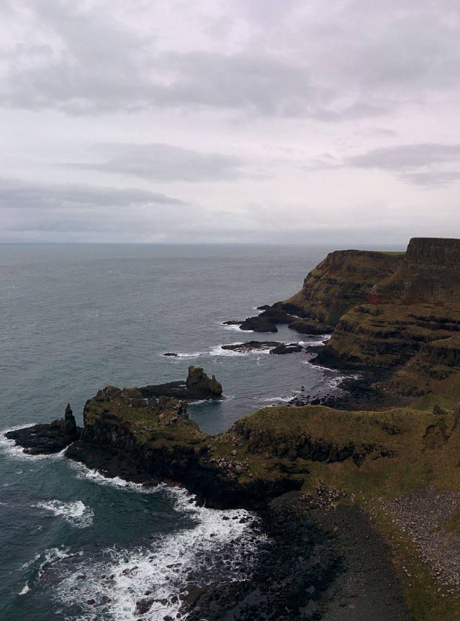
The Causeway Coast is the stretch of shore from around Portrush eastwards to Ballycastle, with the Giant's Causeway and the cliffs near it at the centre. The land behind it is farmland and low hills, with the Glens of Antrim rising to the east and the sea close at hand for much of the way.
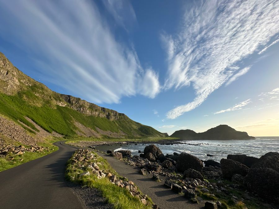
The coast is part of the Causeway Coastal Route, a signed road route that runs between Belfast and Derry~Londonderry. The County Antrim section stays close to the sea and passes the main sites in turn. The road is narrow in places and busy in summer, so allow more time than the miles suggest.
Distances between the main stops are short. Portrush, Bushmills, the causeway and Ballycastle can be linked in a single day by car, though that leaves little time at each. Two nights gives a more comfortable pace and room for a cliff walk.
The coast is in Northern Ireland, so distances are in miles and currency is pounds sterling. There are no routine checks on the road from the Republic, and traffic drives on the left on both sides of the border.
The route is signed but roadworks and seasonal closures happen. Check Traffic Watch NI, run by the Department for Infrastructure, before setting out.
The Giant's Causeway
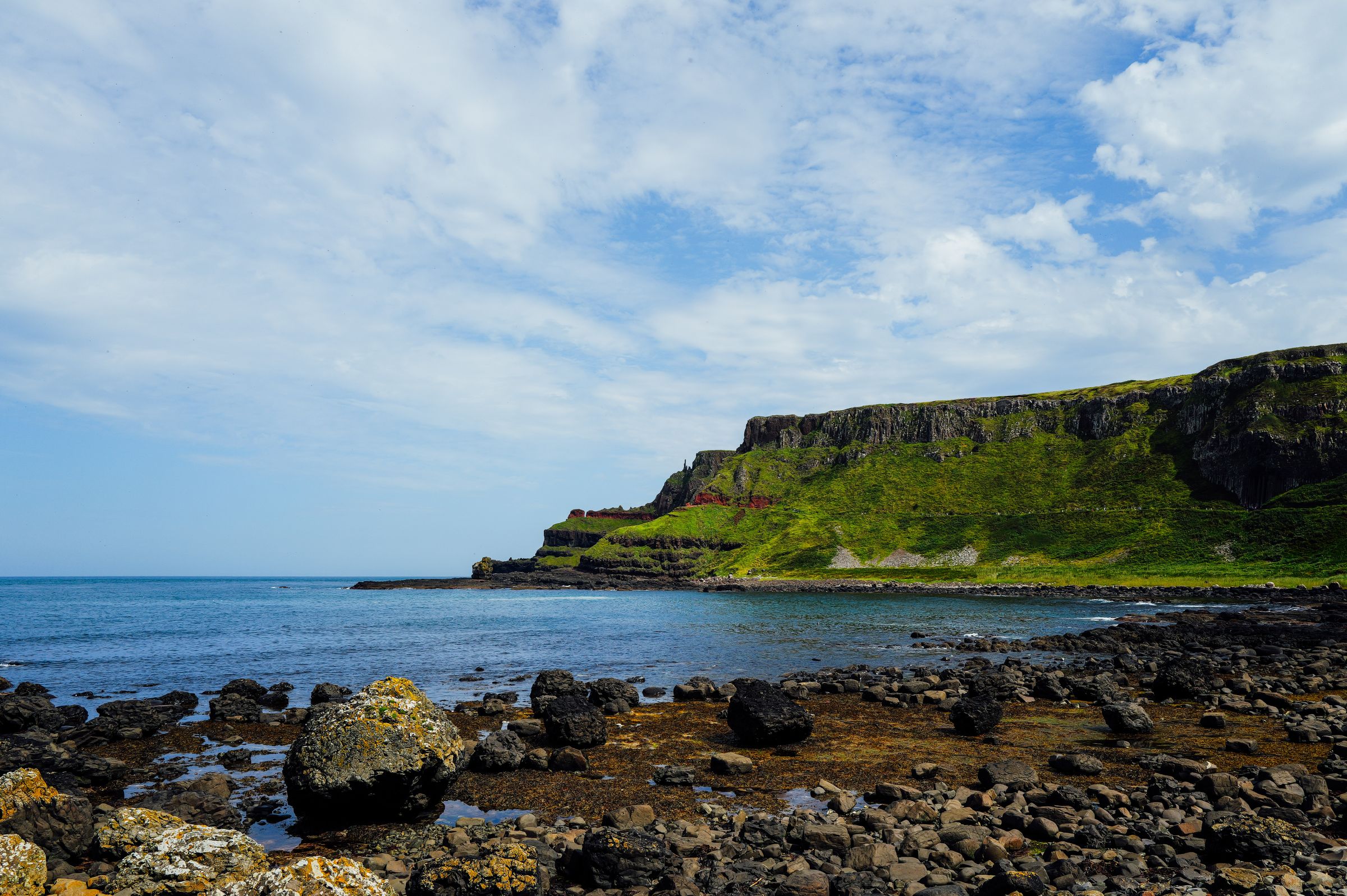
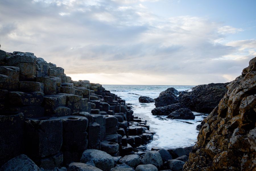
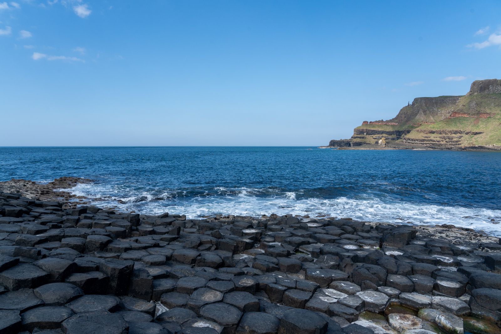
The Giant's Causeway is a field of interlocking basalt columns running from the cliffs into the sea, formed by ancient volcanic activity. It is a UNESCO World Heritage Site, and the stones are free to walk among, though the visitor centre is ticketed. The columns are hexagonal in the main, packed tightly like stepping stones into the water.
The site is cared for by the National Trust. A visitor centre near the cliff top explains the geology and the legends, and a shuttle bus runs down to the stones for those who need it. The walk down and back is short but uneven, and the stones themselves are rounded and slippery in places.
Weather on the exposed headland changes quickly, and spray can reach the stones in a strong wind. Strong footwear and a waterproof are worth carrying in any month. The sea is cold and the rocks are slippery when wet, so keep back from the edge and watch children near the water.
The legend says the columns were built as a road to Scotland, and the same rock formation appears on the Scottish side of the channel. The geology tells a slower story of lava cooling in regular shapes. Either way, the stones are best seen early or late, when the light is low and the crowds thinner.
Dunluce Castle
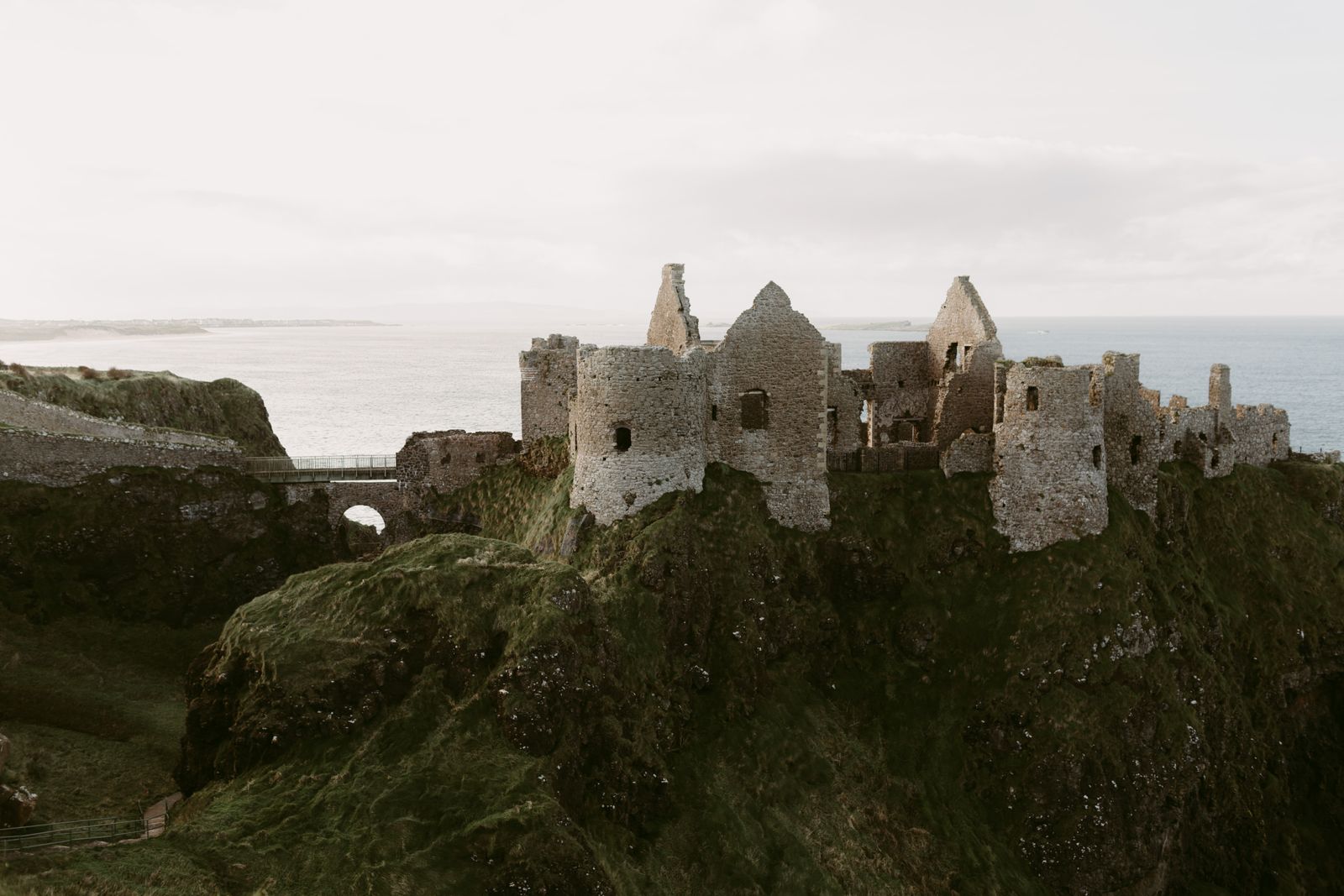
Dunluce Castle stands on a rocky headland west of the causeway, reached by a bridge from the cliff. The ruins are those of a medieval castle held by the MacDonnell family, and parts of the site fell into the sea in the seventeenth century. The remaining walls cling to the rock above the water.
The castle is a state monument in Northern Ireland, cared for by the Department for Communities, and entry is ticketed. The walls and towers are open to walk among, with views along the coast in both directions and down to a sea cave below the rock.
The path from the car park is short but uneven, and the headland is exposed to wind and rain. The castle is often paired with a stop at the causeway, as the two are only a short drive apart. Allow an hour for the ruins and the views.
The castle has passed through several hands and was abandoned by the end of the seventeenth century. What remains is a shell, but the setting above the sea gives a clear sense of why the site was chosen. Interpretive panels on the path explain the families who held it.
Carrick-a-Rede and the cliffs
Carrick-a-Rede is a small island off the coast near Ballintoy, reached by a rope bridge across a gap in the cliffs. The bridge was first built by salmon fishermen, and the crossing is now managed by the National Trust. The island itself is small, grassy and ringed by rock.
Crossing the bridge is ticketed, and the number of people allowed on it at one time is limited. The walk from the car park to the bridge takes in cliff paths and views across to Rathlin Island and, on a clear day, to Scotland. The path is uneven and climbs in places.
The bridge closes in high winds, and the crossing is not suitable for everyone. Those who prefer to stay on the mainland can still walk the cliff path and watch the seabirds. Puffins nest on Rathlin and the nearby cliffs roughly from late spring to midsummer, and dates vary by season.
The cliff path continues past the bridge towards Ballintoy harbour, a small working inlet below the road. The harbour and the strand nearby make a quiet stop after the crowds at the bridge. The whole stretch is exposed, so a warm layer helps even on a bright day.
Bridge opening and wind closures change. Check the National Trust page for Carrick-a-Rede before travelling, and the RSPB for Rathlin Island.
Choosing where to base
Bushmills is the closest village to the causeway, with a compact centre and easy access to the stones and the castle. It suits a short stay focused on the main sites, and the coast road is a few minutes away. The village has a handful of places to eat and stay.
Portrush, a little further west, is a larger seaside town with more choice of places to stay and eat. It has two beaches and a headland walk, and it works well for families. Portstewart, next to Portrush, has a long strand and a cliff path above it.
Ballycastle, to the east, is quieter and makes a good base for the glens and for the ferry to Rathlin Island. The town sits at the end of the coast road, with a beach and a harbour. It is a useful stop before the Glens of Antrim.
Coleraine, inland from Portrush, is a market town with rail links and a wider range of services. It is less scenic than the coast but practical for a longer stay without a car. Buses and trains from Coleraine reach the coastal towns.
Getting there and around
The coast is in Northern Ireland, so distances are in miles and currency is pounds sterling. There are no routine checks on the road from the Republic, and the border crossing is straightforward by car. Entry rules depend on the passport, so check gov.uk for Northern Ireland before travelling.
Trains run from Belfast to Coleraine and Portrush, and buses link the coastal towns. The causeway itself has no railway station, so the last stretch is by bus, car or on foot along the cliff path. Timetables change by season, so check with Translink before relying on a connection.
Driving is the easiest way to link the stops. Traffic drives on the left, as in the Republic. Parking at the causeway and at Carrick-a-Rede fills early in summer, so an early start helps. The coast road is narrow in places and not suited to large vehicles.
The nearest airports are Belfast International and George Best Belfast City, both within reach of the coast by road. City of Derry airport lies to the west. From Dublin, the drive north takes in the border and the approach to Belfast before the coast road begins.
Timetables change by season. Check Translink for trains and buses, and Transport for Ireland for cross-border journeys.
Walking and the weather
The coast has several waymarked walks, including cliff paths between the main sites. The Causeway Coast Way runs along the shore from Portstewart to Ballycastle, in stages, and passes the causeway and the rope bridge. The full route is best split over several days, with a base in one of the coastal towns.
The weather is mild and changeable. Rain is possible in every month, and the north coast is exposed to wind off the sea. A waterproof and a warm layer are worth carrying even in summer. The west and the hills are wetter than the east, but the north coast catches its share of showers.
Daylight is long around midsummer and short in December. Walking the cliff paths in winter means planning around an early dusk. The emergency number is 112 or 999, the same as in the Republic. Phone signal is patchy on parts of the cliffs.
Seabirds nest on the cliffs in spring and early summer, and the path passes close to some of the colonies. Keep to the marked route and give nesting birds room. BirdWatch Ireland covers the Republic and the RSPB covers Northern Ireland, including Rathlin Island.
Check the forecast from the Met Office before a coastal walk, and carry a map, as phone signal is patchy on the cliffs.
Inland and east
Inland from the coast, the Glens of Antrim run down to the sea in a series of valleys. Glenariff and Glenballyemon are among the better known, with forest walks and waterfalls. The glens are quiet compared with the coast and make a good half day away from the stones.
The Dark Hedges, a line of beech trees near Armoy, is a short detour inland. The trees form an arch over the road, and the lane is popular, so an early or late visit is calmer. The road is narrow and used by local traffic.
Ballycastle sits at the eastern end of the coast, with a beach and a harbour and the ferry to Rathlin Island. The island has seabird colonies and a lighthouse, and the crossing is short. Check the ferry operator for the current timetable before planning a crossing.
The coast road continues east towards the Glens and on to Belfast, and west towards Derry~Londonderry. Both cities are within a day's drive and make useful stops before or after the coast. The Causeway Coastal Route links them along the shore.