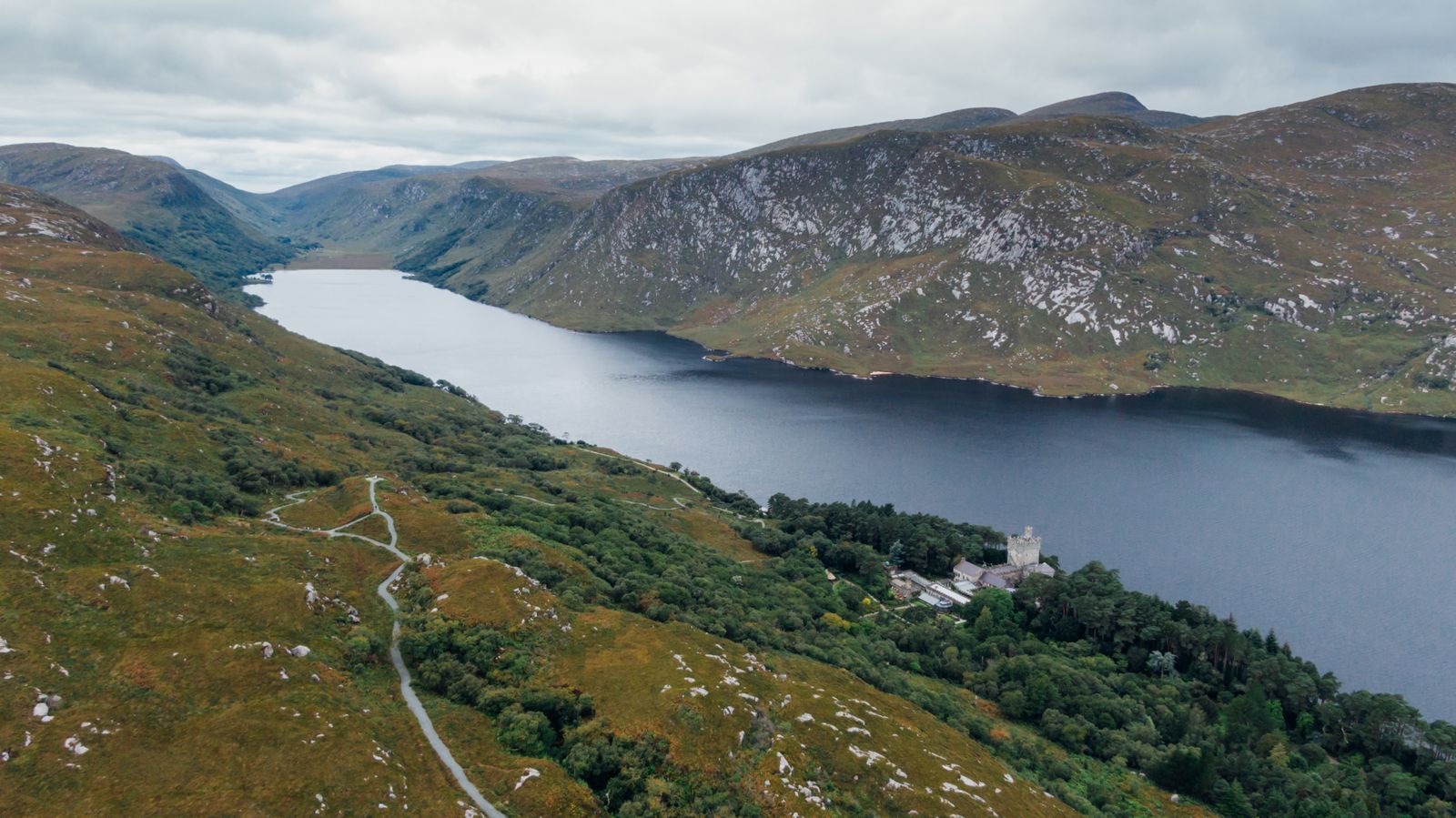
County Donegal sits in the north-west of the island, in the province of Ulster, and is part of the Republic of Ireland. It is a county of high ground and long inlets, with a coast that faces the Atlantic for most of its length and a large Irish-speaking area in the west.
Mountains and coastline
Donegal is a mountainous county. The Derryveagh Mountains run through the centre, with Errigal, a pale quartzite cone, standing above them. To the south, the Bluestack Mountains separate the county from the lowlands around Donegal Town. The high ground continues to the coast in most directions.
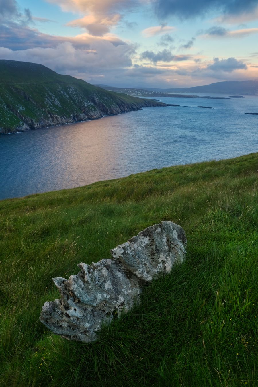
The coast is broken by long inlets: Lough Swilly in the east, Mulroy Bay and Sheephaven in the north, and Donegal Bay in the south. Between them lie peninsulas such as Inishowen, Fanad and Rosguill, each with its own roads, beaches and small harbours.
Much of the interior is blanket bog and rough grazing. The land is wet, and the west of the county takes more rain than the east. Weather can change within an hour, and low cloud often hides the higher ground. Walkers should carry a map and a waterproof in every season.
Check the forecast from Met Éireann before setting out on the hills, and tell someone your route on the higher ground.
Sliabh Liag
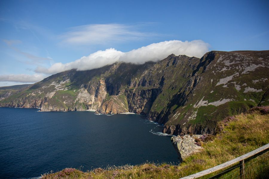
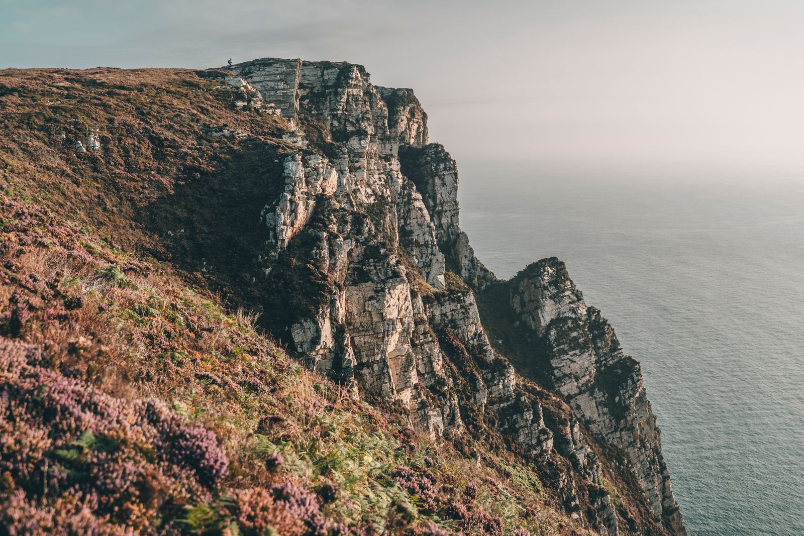
Sliabh Liag, near the village of Teelin in the south-west of the county, is a line of sea cliffs dropping to the Atlantic. The cliffs are among the highest in Europe, and the road and paths above them give long views towards Sligo and Mayo on a clear day.
A visitor centre below the cliffs explains the geology and the history of the area. From there, a path and a road lead up to the viewing points. The ground is exposed, and the cliff edge is unfenced in places, so keep back from the edge and keep children close.
The cliffs are free to walk. The visitor centre is ticketed. The weather decides what can be seen, and the cliffs can disappear into mist without warning, so a check before setting out is worthwhile. Strong winds are common on the exposed ground above the sea.
Glenveagh National Park
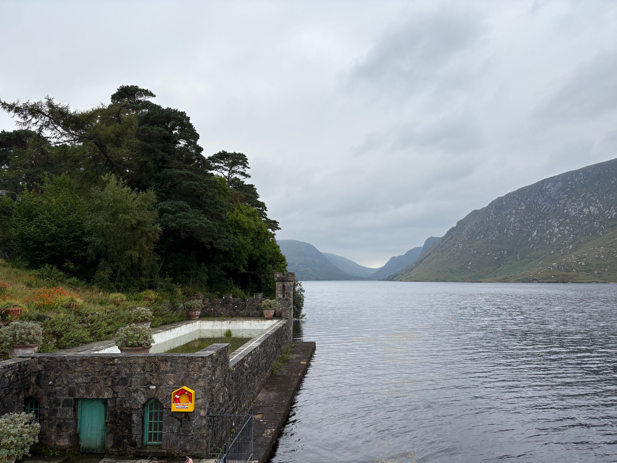
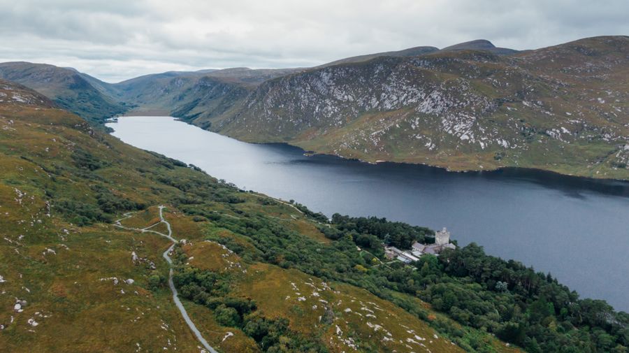
Glenveagh National Park lies in the Derryveagh Mountains, north-west of Letterkenny. The park covers mountain, bog, woodland and the shores of Lough Veagh, and is run by the National Parks and Wildlife Service. It is one of the six national parks in the Republic.
At the centre of the park stands Glenveagh Castle, a nineteenth-century building with a walled garden. A shuttle bus runs from the visitor centre to the castle, and a walking route follows the lake shore for those who prefer to go on foot.
The park holds a herd of red deer, and golden eagles were reintroduced to the area. The hills around the park are high and remote, and paths are not all waymarked. Walking boots and a map are worth carrying, and the weather on the high ground can differ from the car park.
The Irish-speaking west
The west of Donegal, including the Rosses, Gweedore and parts of the Fanad peninsula, is a Gaeltacht: an area where Irish is the community language. Road signs there are in Irish only, so a map that shows both names helps. The Irish names often look nothing like the English versions.
The area has a strong tradition of song and storytelling. Summer colleges bring students to learn Irish, and the language is heard in shops and on the radio. Place names on signs may look unfamiliar, and asking locally is often the quickest way to find a beach or a harbour.
The Donegal coastline here is a series of small harbours and sandy beaches. Fishing has declined, but the harbours are still working places, and the islands of Arranmore and Tory are reached by ferry from the west coast. Check sailing times with the operator, as they change with the season.
Ferries to Arranmore and Tory run to seasonal timetables. Check the current sailings with the operator before planning a crossing.
Bundoran and the south
Bundoran, at the southern edge of the county, faces the Atlantic and has a long record as a seaside resort. The town is known for surfing, and the waves off the beach and nearby reefs draw visitors through the year. Boards and wetsuits can be hired in the town.
Donegal Town, at the head of Donegal Bay, is a market town with a ruined abbey and a castle. It is a useful base for the south of the county and for the road west towards Sliabh Liag. The town sits at the mouth of the River Eske, below the Barnesmore Gap.
The coast between Bundoran and Donegal Town has long beaches and low cliffs. The road along it is part of the Wild Atlantic Way, which begins at Inishowen in the north of the county and runs south from there. The route is signed, and the whole county is on it.
Choosing a base
Letterkenny is the largest town in the county and a practical base for the centre and north, with the most choice of accommodation and services. It sits at the head of Lough Swilly, within reach of Glenveagh and the Fanad peninsula, and has bus links to the rest of the county.
Donegal Town suits the south of the county, with Sliabh Liag and Bundoran within a day's drive. Ardara and Killybegs, on the south-west coast, are smaller bases close to the cliffs and the fishing harbours. Both have a few places to stay and eat.
In the north-west, Dungloe and Gweedore serve the Rosses and the Gaeltacht. Bunbeg and Dunfanaghy are smaller again, close to beaches and the edge of the national park. A car makes all of these easier to use, and the booking search on this page is set to the Donegal region.
Book accommodation early in July and August, when the Gaeltacht colleges and coastal resorts are at their busiest.
Getting there and around
Donegal has no railway. The nearest stations are in Sligo and Derry~Londonderry, and bus services connect both to towns in the county. Bus Éireann and private operators run routes from Dublin and Galway, and TFI Local Link buses serve rural areas. Timetables change, so check with the operator.
Donegal Airport, at Carrickfinn in the north-west, has flights to Dublin. The main airports for the county are City of Derry and Ireland West (Knock), with Dublin and Belfast International further away. Car hire is available at the larger airports.
By road, the county is reached from Dublin through the north Midlands, and from Belfast and Derry~Londonderry through Northern Ireland. The border is crossed without routine checks. Traffic drives on the left throughout, and the county uses the euro and kilometres.
Timetables change with the season. Check the current times with Bus Éireann, TFI Local Link or the relevant operator before travelling.