Ireland's Ancient East is a touring region rather than a single road. It covers the east and south of the Republic, from the Boyne Valley down through the midlands to Waterford and west towards Cork. The draw is inland heritage: abbeys, high crosses, castles and old town walls.
What the route is
Ireland's Ancient East is a place brand created by Fáilte Ireland, the national tourism authority, to group the heritage of the east and south under one name. It is not a signed driving route in the way the Wild Atlantic Way is, and there is no single road to follow. Instead it takes in counties from Louth and Meath down through the midlands to Wexford, Waterford, Kilkenny and Tipperary, with Cork and its hinterland at the southern edge.
The region is presented in themes: ancient Ireland, early Christian Ireland, the medieval era and the country house tradition. In practice this means a loose collection of sites, some run by the Office of Public Works, some by local authorities, some in private or church hands. The official Ireland's Ancient East website lists what is open and groups it by area, which is the sensible place to start when planning a route.
Because the region is large, most visitors pick a corner rather than try to cover it all. The Boyne Valley north of Dublin, the monastic sites of Wicklow, the medieval streets of Kilkenny and the Viking and Norman heritage of Waterford and Wexford are the usual anchors. A car makes the smaller sites reachable; trains and coaches link the main towns.
Opening arrangements at smaller sites change with the season. Check with the Office of Public Works or Heritage Ireland before building a day around one.
The Boyne Valley
North of Dublin, the Boyne Valley holds the densest concentration of ancient monuments in the region. Brú na Bóinne, near Slane in County Meath, is a UNESCO World Heritage Site and includes the passage tombs of Newgrange and Knowth. Access to the chambers is by guided tour from the visitor centre, and numbers are limited, so booking ahead is wise. The Office of Public Works runs the site and publishes opening arrangements.
Nearby are the Hill of Tara, seat of the high kings in early Irish tradition, and the battlefield of the Boyne at Oldbridge, with its visitor centre and parkland. Trim has a large Norman castle on the river, and Kells in Meath gives its name to the illuminated manuscript now kept in Dublin. The area is easily reached from Dublin by road, and day tours run from the city.
This corner suits a short break from Dublin rather than a long stay. The towns of Navan, Trim and Drogheda have beds and food, and the coast at Bettystown and Laytown is close. Public transport reaches Drogheda and Navan, but the monuments themselves are scattered across country roads, so a car or a tour is the practical way to link them.
Monastic Ireland
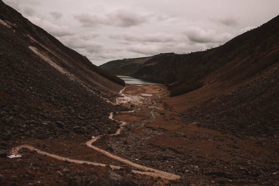
The early Christian monasteries are the heart of the region. Glendalough in County Wicklow, set in a valley between two lakes, has a round tower, a cathedral ruin and stone churches, with a visitor centre run by the Office of Public Works. The Wicklow Mountains around it offer walking, and the site is reachable by bus from Dublin and by road from the towns of Wicklow and Rathdrum.
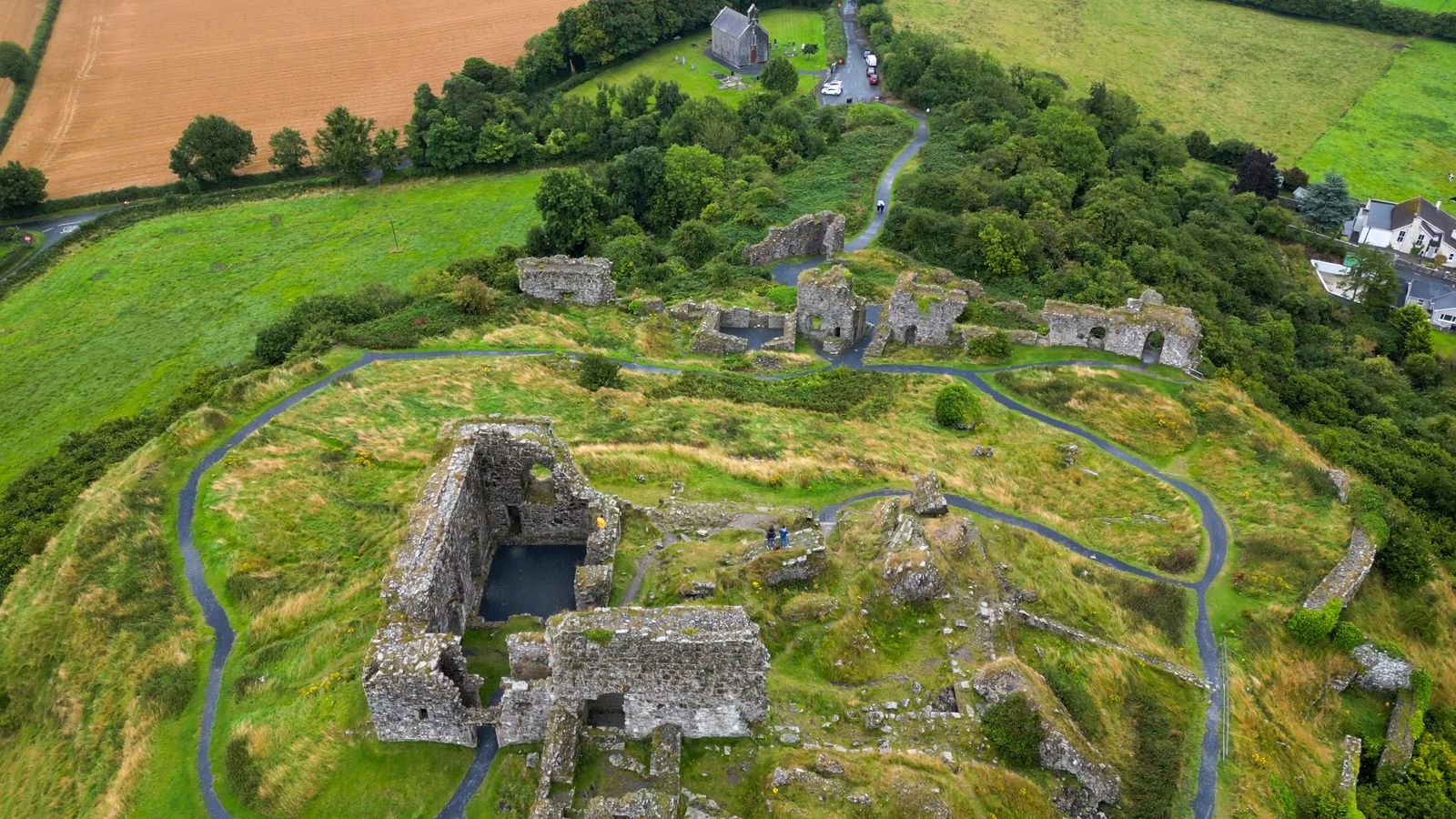
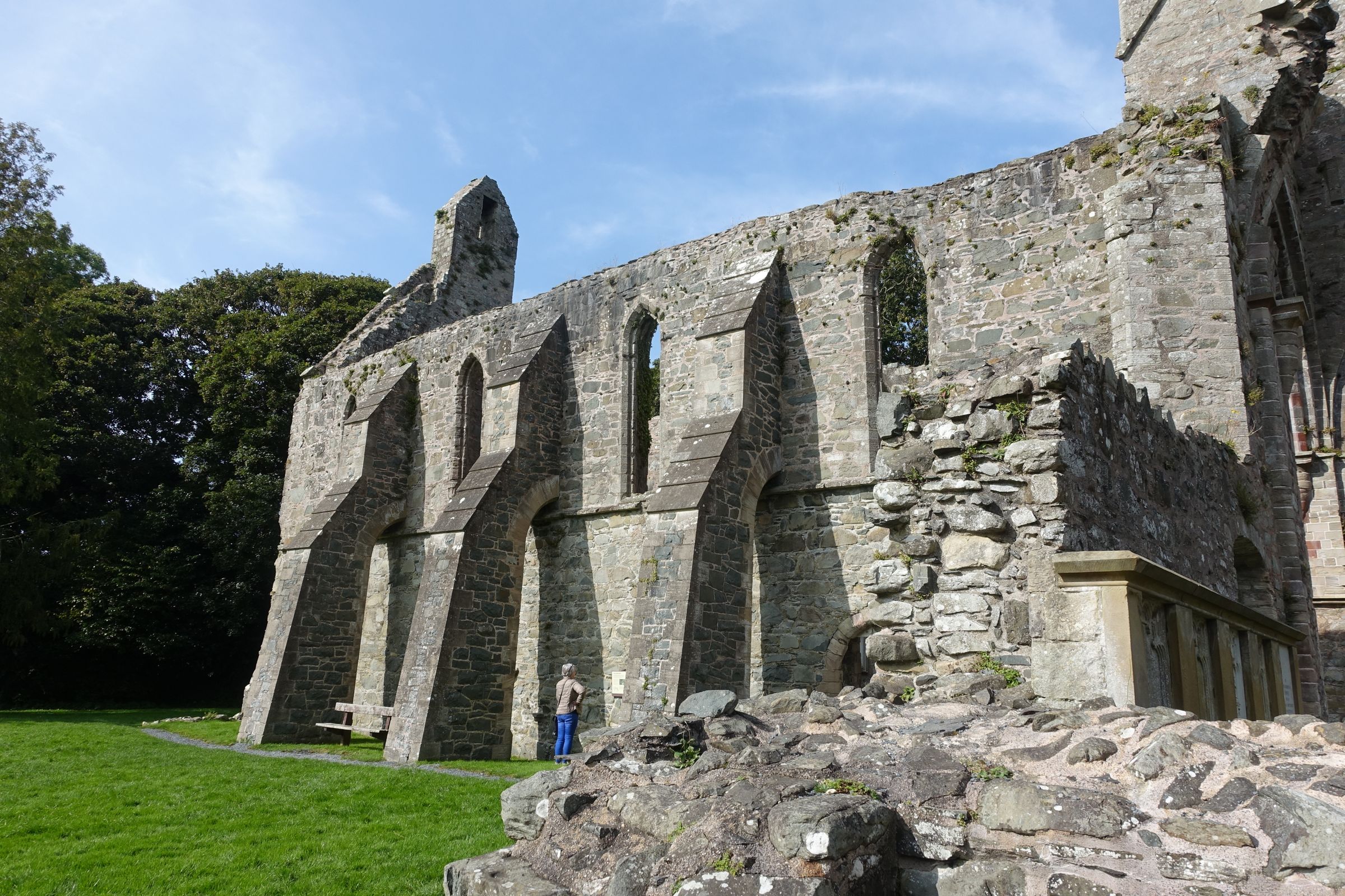
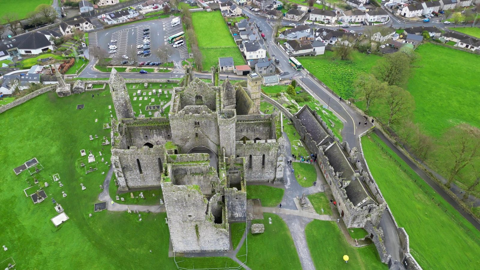
Further south, Jerpoint Abbey in County Kilkenny is a Cistercian ruin known for its carved cloister arcade, and the Rock of Cashel in County Tipperary rises above the plain with a cluster of churches and a round tower on top. Clonmacnoise, on the Shannon in County Offaly, is a major monastic site with high crosses and round towers, run by the Office of Public Works. Each has its own opening arrangements, which change with the season.
These sites reward a slower pace. Many have small visitor centres, guided tours at set times and uneven ground underfoot. The high crosses and round towers that recur across the region are worth reading up on before you go, as the carvings and construction are easier to follow with a little background. Check opening times with the Office of Public Works or Heritage Ireland before travelling.
Kilkenny as a base
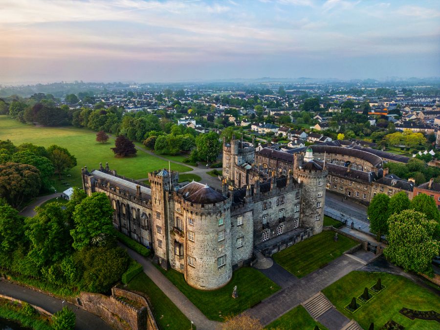
Kilkenny is the natural centre for the middle of the region. The city is compact and medieval in plan, with a castle at one end of the main street, a cathedral on the hill above and a network of lanes between. Kilkenny Castle is run by the Office of Public Works, and the city has a strong craft and food scene in its old streets. It sits on the river Nore, with walks along the bank.
From Kilkenny, a wide ring of sites is within an easy drive: Jerpoint Abbey, the monastic settlement at Kells in County Kilkenny, the Rock of Cashel to the west, and the villages of the Barrow valley. The city also has rail and coach connections, which makes it workable without a car for the town itself, though the outlying sites need transport. Timetables change, so check with Iarnród Éireann and Bus Éireann.
Other towns serve the same purpose in different corners. Waterford suits the south east, Wexford the coast and the Norman sites around it, and Drogheda or Trim the Boyne Valley. Carlow and Athy sit in the midlands. Choosing a base near the sites you most want to see saves long drives, as the region is wide and the roads between small sites are often narrow.
Rail and coach times on the Kilkenny and Waterford lines change between seasons. Confirm with Iarnród Éireann and Bus Éireann before planning a car-free day.
Waterford and Wexford
The south east has a strong Viking and Norman story. Waterford is a walled city with Viking origins, and its museums cover the medieval city and its trading past. The city is a good base for the Copper Coast, a stretch of cliffs and coves to the west, and for the Suir valley. The Waterford Greenway, a traffic-free trail on an old railway line, runs from the city towards Dungarvan and is popular with cyclists and walkers.
Wexford town sits at the head of its harbour, with a history that takes in the Norman landing and the 1798 rebellion. The county has beaches, birdlife at the slobs and the Irish National Heritage Park, which reconstructs dwellings and monuments from different periods. Enniscorthy and New Ross have their own heritage sites, and the Barrow and Suir rivers meet the sea nearby.
This corner is quieter than the east coast around Dublin and suits a relaxed few days. The coast road and the greenway make it easy to move between towns, and the area is well served by buses and, on some lines, by rail. As everywhere in the region, opening times for smaller sites vary, so confirm before setting out.
Getting around
Driving is the simplest way to cover Ireland's Ancient East, as many sites sit on country roads away from rail lines. Traffic drives on the left, distances are in kilometres and speed limits in km/h in the Republic. Roads between the main towns are good; the lanes to smaller sites are narrow and often single track with passing places. Allow more time than a map suggests.
Public transport links the main towns well. Trains from Dublin run to Kilkenny, Waterford, Wexford and Carlow, and coaches reach most county towns. Local buses, including TFI Local Link services, fill some rural gaps, but they run infrequently and not always daily. For a car-free trip, base in a town with a station and use tours or taxis for the outlying sites. Transport for Ireland has a journey planner.
The region is entirely within the Republic of Ireland, so the currency is the euro and there are no border formalities within it. Entry rules depend on your passport; check the Irish Immigration Service before travelling. Emergency numbers are 112 and 999, and plugs are the three-pin type G. Timetables and opening hours change with the season, so check with the operator or site before you rely on them.
When to go
The climate is temperate and rain is possible in every month, with the east generally drier than the west. Summer brings long evenings, with daylight in Dublin running to about seventeen hours around the June solstice, which suits late visits to ruins and gardens. Spring and autumn are quieter and often pleasant, with fewer visitors at the main sites.
Winter is mild but dark, with about seven and a half hours of daylight in late December. Many smaller heritage sites close or run reduced hours outside the main season, so check with the Office of Public Works or Heritage Ireland before planning a winter route around them. Larger towns and cities stay open year round.
The region is busy at bank holiday weekends and in high summer, especially at Brú na Bóinne and the Rock of Cashel, where timed tours can fill up. Booking ahead for those helps. Otherwise the east and south absorb visitors well, and the smaller monastic sites are often quiet even in August. Pack for rain and wear shoes suited to uneven ground at the ruins.