An Irish regional road marked L on the signpost can narrow to a single lane with grass growing up the middle, hemmed by drystone walls in County Galway or Fuchsia hedges in West Cork. The national secondary routes, the N roads, are generally two full lanes, but the last five kilometres to anywhere scenic is usually where it tightens. Passing places appear on one side only, so the rule is simple: whoever reaches the wider spot first pulls in, and a raised hand through the windscreen says thank you. Drive on the left, keep the wing mirror folded on the tightest stretches, and expect a tractor around any corner between April and September.
What a Regional Road Actually Feels Like
Speed limits are a poor guide to what is safe. An 80 km/h sign on a boreen outside Kenmare or Clifden means little when the surface dips and the hedges block sightlines; 50 to 60 km/h is realistic on most single-track roads, and a 40-kilometre stretch can easily take an hour. Google Maps and Apple Maps routinely route drivers down lanes that are not suited to a rental car, particularly around the Sally Gap in Wicklow or the Conor Pass above Dingle. Check the road classification before you trust the blue line, and if the route looks like a squiggle, plan an alternative on the N road even if it adds twenty minutes.
Car, Insurance and the Practical Kit
Book a compact or mid-size car rather than an SUV unless you genuinely need the space; a wider vehicle is a liability on a boreen, and a small hatchback is easier in the car parks at Glendalough, Muckross House or the Cliffs of Moher. Most Irish rental desks push super damage cover at collection, typically a daily rate that can rival the rental itself, and standalone excess policies bought in advance cost far less. Check the excess, the tyre and windscreen exclusions, and whether the car is diesel or petrol before you leave the lot. An automatic costs more and is scarcer, so reserve early if you do not drive manual.
Fuel up before heading west or into the mountains. Petrol stations thin out beyond towns like Clifden, Belmullet, Dingle and Glengarriff, and some rural pumps close by early evening or on Sundays. Carry a phone mount and a charging cable, keep a physical map or offline download because signal drops through the Maam Valley and the Wicklow Mountains, and pack a cloth for the windscreen, which mists at dawn. Irish weather changes fast, so headlights on in rain and a spare layer in the boot are sensible habits rather than precautions.
Route Planning and Where to Base Yourself
The Wild Atlantic Way is not one road but a signed route stitching together hundreds of kilometres of coast, and attempting the whole thing in a week is a mistake. Pick a stretch: Connemara and Mayo from Galway, or the Dingle and Iveragh peninsulas from Killarney, or the Causeway Coast from Belfast. Dublin to Galway is roughly two and a half hours on the M6, Galway to Clifden another hour and a half, and Killarney to Dingle around an hour on the N86. Book two or three nights per base rather than moving daily; unpacking once and driving loops is far less tiring than hauling luggage every morning.
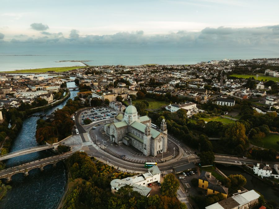
For a first driving trip, I would base in Galway city for Connemara and the Burren, then move to Killarney or Kenmare for the Kerry peninsulas. Galway gives you a compact street network, a station and easy access to the N59, while Kenmare sits at the head of the Beara and Iveragh routes without the traffic of Killarney in July. Cork city works well for West Cork and the Copper Coast, and Sligo town is the practical base for Benbulben and the north-west. Book accommodation with private parking where possible; town-centre hotels on street meters are a nuisance, and rural hotels on the N roads are easier to reach in the dark.
Timing, Weather and the Things to Skip
May, June and September are the sweet spot: long evenings, fewer tour buses and daylight past 21:30 in June, which matters when you are still navigating single-track lanes at eight in the evening. July and August bring the most traffic, particularly around Killarney, Doolough and the Ring of Kerry, where coaches crawl and cyclists share the verge. Winter driving is quiet but daylight ends around 16:30 in December, and frost, fog and standing water on secondary roads make remote stretches slower. Wind and rain arrive year-round, so treat any forecast as advisory and build slack into each day rather than racing a schedule.
Skip the Conor Pass in a large vehicle or in low cloud, and think twice about the Healy Pass on the Beara Peninsula if you are not confident reversing into a passing place. The Gap of Dunloe is better walked or cycled than driven, and many narrow mountain roads around Glencree and the Wicklow uplands are not worth the stress when the same views are visible from the R759. In towns, park outside the centre and walk; the one-way systems in Galway, Cork and Kilkenny are hard to read on the move. Allow an extra thirty percent on every estimated drive time and the trip becomes enjoyable rather than tense.